|
 Multispectral remote sensing Multispectral remote sensing
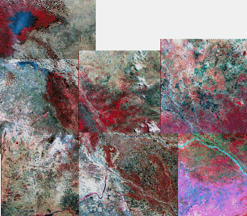
Mosaic of Landsat color composite produced using TeraVue on extracted data from USGS Internet on-line data store  
|
MSS image interpretation
Radar remote sensing
- Characteristics of Radar
Microwave region
Active sensor
- Source of data
Aerial
Satellite based (JERS, ERS, Radarsat)
Radar interpretation
- Tonal Patterns
Geometry of radar illumination
- Surface Roughness
Smooth (specular)
Grass, savanna
Water: Ocean, river
Rough (diffuse) : forest
- Radar - Examples
Corner reflectors - urban
Texture image processing
Method for inferring structural information
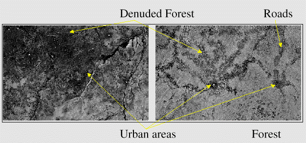
Interpretation of radar imagery on the Doba area in Chad
after integration using TeraVueSource
http://southport.jpl.nasa.gov/GRFM/ 
|
|